| Communities > Alnwick > Plans | About Contact |

Alnwick - Plans
| Amble |
Speed's map of Northumberland
(1610)
Ref: ZAN M16 B21
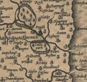 More info...
With permission of the Society of Antiquaries of Newcastle upon Tyne
|
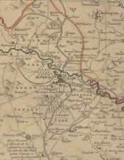
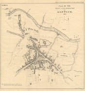
Armstrong's Map of Northumberland
(1769)
Ref: ZBK sheet 6
 |
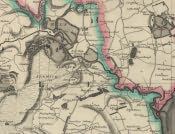
Armstrong's Map of Northumberland, Alnwick Plan
(1769)
Ref: ZBK sheet 4
 |
Fryer's Map of Northumberland
(1820)
Ref: NRO 1356/P/1 sheet 4
 |
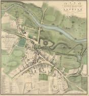
Alnwick, Woods Town Map
(1827)
Ref: ZHE 5-11
 |
Greenwood's Map of Northumberland
(1828)
Ref: ZCR PLANS 42 sheet 4
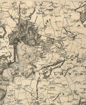 |
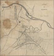
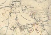
Cholera Outbreak Plan
(1849)
Ref: ZHE 2-13 [1]
 |
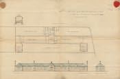
Alnwick St. Mary's National School Building Plan
(1854)
Ref: NDE-4-1
 |
Land Valuation Book
(1910)
Ref: NRO 2000-11
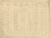 More info...
With permission of the National Archives
|
Land Valuation Map
(1910)
Ref: Sheet 32.13
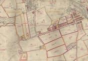 More info...
With permission of the National Archives
|
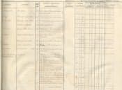
Tithe Award, Plan
(31st December 1846)
Ref: DT 11 L
 More info...
With permission of the Diocese of Newcastle
|
Tithe Award, Text
(31st December 1846)
Ref: DT 11 L
 More info...
With permission of the Diocese of Newcastle
|
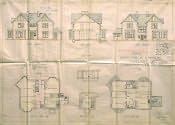
Alnwick Building Plan
(3rd June 1898)
Ref: NRO 755-P-617
 |