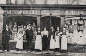
Greenhead is a small village in west Northumberland. It is 20 miles west of Hexham just off the A69 main Newcastle-Carlisle road. Since 1892 it has been an ecclesiastical parish. Its name is said to refer to its location between Tipalt Burn and the river Irthing.
The church erected in 1828, was designed by the well known Newcastle architect John Dobson when Greenhead was a chapelry of the parish of Haltwhistle. The surrounding settlements of Thirlwall and Blenkinsopp each have castles built during the medieval period when the area was subject to much border raiding. Thirlwall castle is ruined but Blenkinsopp was restored in 1880.
In more recent centuries, the railway came to Greenhead in the 1830s with the building of the Newcastle to Carlisle railway. This replaced a scheme to build a canal between the two towns.
In 1801 the combined population of Blenkinsopp and Thirlwall townships was 518 and by 1851 this had risen to 1221. This was probably due to increase in coal mining in the area.
It is believed that the local coal mine was named Byron in honour of one of the local landowners in the 19th century, Mrs Coulson who was a daughter of Lord Byron. A row of houses called Byron Terrace still exists near Blenkinsopp Colliery
Today the village is visited by tourists exploring Hadrians Wall AND
the neighbouring village OF Gilsland IS IN the unusual situation OF straddling the Northumberland - Cumbria county boundary

 Greenhead is a small village in west Northumberland. It is 20 miles west of Hexham just off the A69 main Newcastle-Carlisle road. Since 1892 it has been an ecclesiastical parish. Its name is said to refer to its location between Tipalt Burn and the river Irthing.
The church erected in 1828, was designed by the well known Newcastle architect John Dobson when Greenhead was a chapelry of the parish of Haltwhistle. The surrounding settlements of Thirlwall and Blenkinsopp each have castles built during the medieval period when the area was subject to much border raiding. Thirlwall castle is ruined but Blenkinsopp was restored in 1880.
In more recent centuries, the railway came to Greenhead in the 1830s with the building of the Newcastle to Carlisle railway. This replaced a scheme to build a canal between the two towns.
In 1801 the combined population of Blenkinsopp and Thirlwall townships was 518 and by 1851 this had risen to 1221. This was probably due to increase in coal mining in the area.
It is believed that the local coal mine was named Byron in honour of one of the local landowners in the 19th century, Mrs Coulson who was a daughter of Lord Byron. A row of houses called Byron Terrace still exists near Blenkinsopp Colliery
Today the village is visited by tourists exploring Hadrians Wall AND
the neighbouring village OF Gilsland IS IN the unusual situation OF straddling the Northumberland - Cumbria county boundary