| Communities > Kirknewton > Ordnance Maps | About Contact |

Kirknewton - Ordnance Maps
| Lesbury |
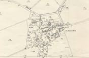
First Edition 25 inch to 1 mile
(c. 1860)
Ref: Sheet 19 enlargement
 More info...
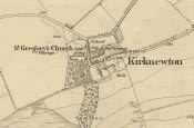
Reproduced from the 1860 Ordnance Survey Map
|
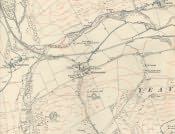
First edition 6 inch to 1 mile
(c. 1860)
Ref: Sheet 19
 More info...
Reproduced from the 1860 Ordnance Survey Map
|
Second Edition 25 inch to 1 mile
(c. 1897)
Ref: Sheet 19.1
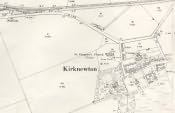 More info...
Reproduced from the 1897 Ordnance Survey Map
|
Second Edition 6 inch to 1 mile
(c. 1897)
Ref: Sheet 19 NW
 More info...
Reproduced from the 1897 Ordnance Survey Map
|
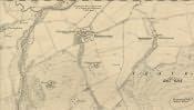
Third Edition 25 inch to 1 mile
(c. 1920)
Ref: Sheet 15.6
 More info...
Reproduced from the 1920 Ordnance Survey Map
|
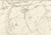
Third Edition 6 inch to 1 mile
(c. 1920)
Ref: Sheet 15 NW
 More info...
Reproduced from the 1920 Ordnance Survey Map
|