| Communities > Scremerston > Plans | About Contact |

Scremerston - Plans
| Seahouses |
Speed's map of Northumberland
(1610)
Ref: ZAN M16 B21
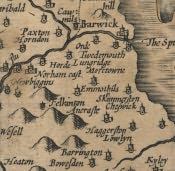 More info...
With permission of the Society of Antiquaries of Newcastle upon Tyne
|
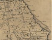
Armstrong's Map of Northumberland
(1769)
Ref: ZBK sheet 2
 |
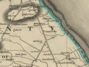
Fryer's Map of Northumberland
(1820)
Ref: NRO 1356/P/1 sheet 2
 |
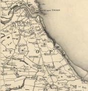
Greenwood's Map of Northumberland
(1828)
Ref: ZCR PLANS 42 sheet 2
 |
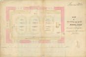
Scremerston National School Building Plan
(1839)
Ref: NDE-30-9
 |
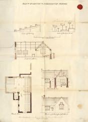
Scremerston National School Building Plan
(1839)
Ref: NDE-30-10
 |
Land Valuation Book
(1910)
Ref: NRO 2000-15
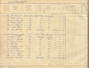 More info...
With permission of the National Archives
|
Land Valuation Map
(1910)
Ref: Sheet 7.6
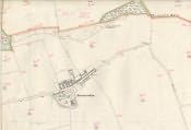 More info...
With permission of the National Archives
|
Tithe Award, Plan
(7th May 1839)
Ref: DT 409 S
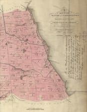 More info...
With permission of the Diocese of Newcastle
|
Tithe Award, Text
(7th May 1839)
Ref: DT 409 S
More info...
With permission of the Diocese of Newcastle
|