| Communities > Ellington > Plans | About Contact |

Ellington - Plans
| Embleton |
Speed's map of Northumberland
(1610)
Ref: ZAN M16 B21
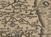 More info...
With permission of the Society of Antiquaries of Newcastle upon Tyne
|
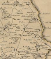
Armstrong's Map of Northumberland
(1769)
Ref: ZBK sheet 6
 |
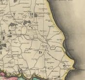
Fryer's Map of Northumberland
(1820)
Ref: NRO 1356/P/1 sheet 4
 |
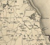
Greenwood's Map of Northumberland
(1828)
Ref: ZCR PLANS 42 sheet 4
 |
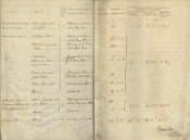
Land Valuation Book
(1910)
Ref: NRO 2000-62
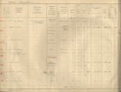 More info...
With permission of the National Archives
|
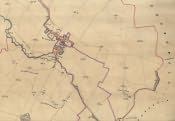
Land Valuation Map
(1910)
Ref: Sheet 64.4
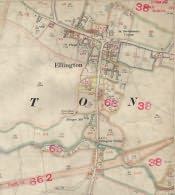 More info...
With permission of the National Archives
|
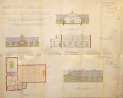
Ellington Colliery Hall and Institute
(20th March 1923)
Ref: NRO 1149 PLAN 346
 |
Tithe Award, Enlarged Plan
(26th October 1842)
Ref: DT 163 M
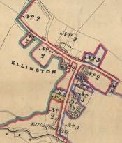 More info...
With permission of the Diocese of Newcastle
|
Tithe Award, Plan
(26th October 1842)
Ref: DT 163 M
 More info...
With permission of the Diocese of Newcastle
|
Tithe Award, Text
(26th October 1842)
Ref: DT 163 M
 More info...
With permission of the Diocese of Newcastle
|