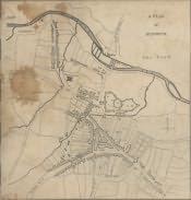
This is a section of Lieutenant Andrew Armstrong & Son's Map of the County of Northumberland, 1769, showing an enlarged plan of Alnwick.
Armstrong's map was drawn to the scale of one inch to one mile. It was the first map of the county drawn to such a large scale and the first to bear the name "Roman Wall". The map was very expensive to produce. Local landowners such as Hugh Percy, Duke of Northumberland, paid for part of this cost. In return, these landowners had their names recorded on the map.