| Communities > Chillingham > Plans | About Contact |

Chillingham - Plans
Fryer's Map of Northumberland (1820)
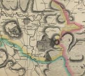 This is a section of John Fryer & Sons' Map of the County of Northumberland, 1820, showing Chillingham and the surrounding area.\r\nJohn Fryer's Map was drawn to a scale of approximately one inch to one mile and was the first map of Northumberland showing its correct position by the lines of latitude and longitude.