| Communities > Crookham > Plans | About Contact |

Crookham - Plans
Greenwood's Map of Northumberland (1828)
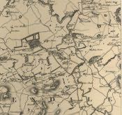 This is a section of Christopher & John Greenwoods' Map of the County of Northumberland, 1828, showing Crookham and the surrounding area.\r\n\r\nGreenwood's map was drawn to a scale of approximately one inch to three miles. It was surveyed and printed between 1827 & 1828.