| Communities > Prudhoe > Plans | About Contact |

Prudhoe - Plans
| Riding Mill |
Speed's map of Northumberland
(1610)
Ref: ZAN M16 B21
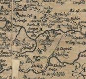 More info...
With permission of the Society of Antiquaries of Newcastle upon Tyne
|
Armstrong's Map of Northumberland
(1769)
Ref: ZBK sheet 8
 |
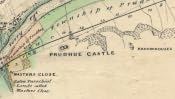
Plans of Prudhoe Castle
(c. 1800)
Ref: ZAN BELL 9-8
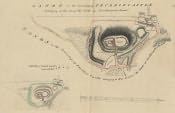 More info...
With permission of The Society of Antiquaries of Newcastle upon Tyne
|
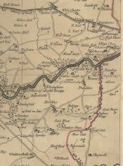
Fryer's Map of Northumberland
(1820)
Ref: NRO 1356/P/1 sheet 6
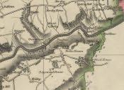 |
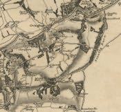
Greenwood's Map of Northumberland
(1828)
Ref: ZCR PLANS 42 sheet 6
 |
Land Valuation Book
(1910)
Ref: NRO 2000-66
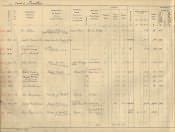 More info...
With permission of the National Archives
|
Land Valuation Map
(1910)
Ref: Sheet 96.9
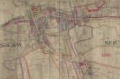 More info...
With permission of the National Archives
|
Newcastle to Carlisle Railway
(30th November 1825)
Ref: QRUP 17
 |
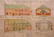
Palace Theatre
(7th August 1912)
Ref: LPR-G1-93 [1]
 |
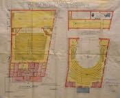
Palace Theatre
(7th August 1912)
Ref: LPR-G1-93 [2]
 |